Reduce font size Increase font size
  • Hrvatski
  • VIKENDPLANER.info
  • Archive
    • NuH 2012
    • NuH 2013
    • See the brochure
  • Contakt
  • Add to favorites
  • Homepage
  • Search

  • Istria
    • Istria county
  • Kvarner
    • Primorje - Gorski Kotar county
  • Dalmatia - Zadar
    • Zadar county
  • Dalmatia - Šibenik
    • Šibenik - Knin county
  • Dalmatia - Split
    • Split - Dalmatia county
  • Dalmatia - Dubrovnik
    • Dubrovnik - Neretva county
  • Lika and Karlovac
    • Lika -Senj county
    • Karlovac county
  • Central Croatia
    • Sisak - Moslavina county
    • Bjelovar - Bilogora county
  • Zagreb and surroundings
    • City of Zagreb
    • Zagreb county
  • Northern Croatia
    • Krapina - Zagorje county
    • Varaždin county
    • Međimurje county
    • Koprivnica - Križevci county
  • Slavonia - West
    • Brod - Posavina county
    • Požega - Slavonia county
    • Virovitica - Podravina county
  • Slavonia - Srijem and Baranja
    • Vukovar - Srymia county
    • Osijek - Baranja county
My plan

You have ideas: 0

View the plan
Sign up!
Sign up!
Weather forecast
°C More...
prize game
  • » Vote for the best in your county and win a perfect weekend for two!
Newsletter
Show The Best in Croatia on Google map
  • Nature
  • History
  • People
  • Events
  • Culture
  • Sport
  • Restaurants
  • Hotels
  • Fun&Party
  • Shopping
  • Products
  • i
Zagreb and surroundings » Zagreb county » Nature
«»

LANDSCAPE ISLAND IVANIĆ

An oasis of untouched nature extends to 380 square kilometers southeast of Zagreb.

10,71 %
Add to My plan
Ideas for weekend

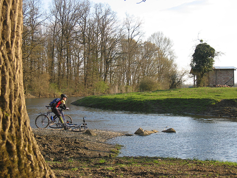
Do you get off on the 27th kilometer from the highway Zagreb - Lipovac, you will find yourself in a beautiful oasis of untouched nature. Ivanic gentle landscape of the island covers an area of ​​380 square kilometers southeast of Zagreb. In the fertile plain, rich with water, and the gentle slopes of vineyards and hills Moslavačke up, there is 56 settlements, among which are the largest and most Ivanic-Grad, Klostar Ivanic and the Cross. In the past, the end of the island got its name because of the river Glogovnica, Lonja and Česma that surround it, and nearby is a Sava.To is both the northwestern edge of the Lonja field, the world-famous park and a significant nature. Lonja field is a habitat of many today, but, unfortunately, rare wading birds, among which the most significant are protected by black and white storks, herons spoonbills, white and gray herons, and protected by a large water bittern and other residents of the bar, fields and forests. At the edge of the Lonja field is a large forest Jaundice, in which the last few years settled the beaver issue in Germany.
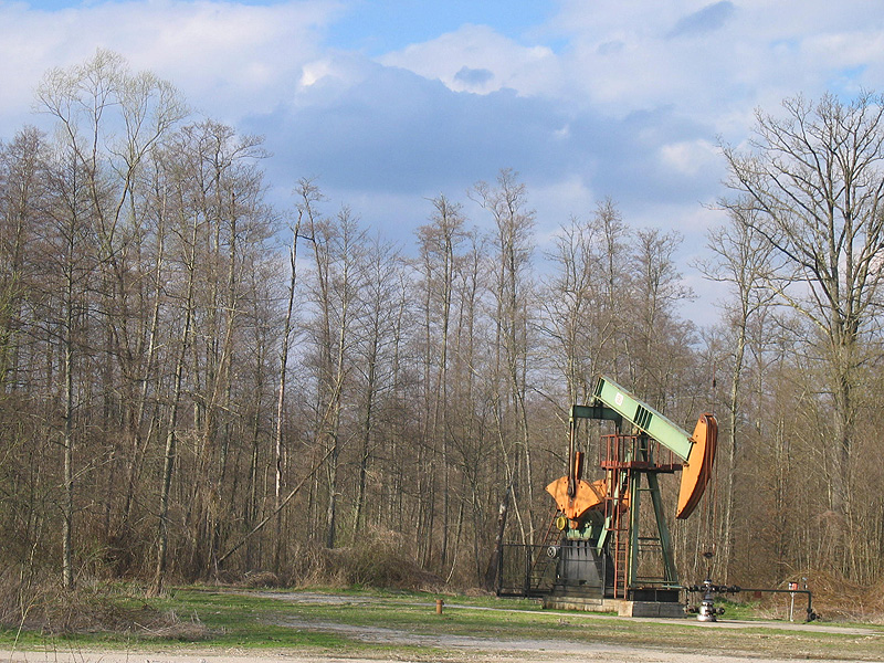
Ivanic Island Area boundary is actually part of the Pannonian alluvial plains, which are remnants of oil and gas. What makes this area unique in Europe and beyond, are certainly very few sources of mineral oil, naphthalene, and rich in geothermal sources of natural saline water, with whose existence is tied renowned spa "Naftalan" in Ivanic Grad. Despite the oil industry developed land Islands Ivanic is preserved and ecologically suitable for crop production and animal husbandry.
 

  • Send inquiry
  • Forward to friend
  • Print
  • Comments
0

To send an inquiry/reservation of accommodation fill in the following form
Choose the dates


Refresh image

Only registrated users can comment To comment you must register. To register follow the link "Log in". If you do not have a username, please registrate using the link "Sign up".

All comments: 0


Refresh image

Image gallery Order photographs

Left
 LANDSCAPE ISLAND IVANIĆ
 LANDSCAPE ISLAND IVANIĆ
Right

Location

Adresa: TZ grada Ivanić-Grada, Moslavačka 13, 10310 Ivanić-Grad
Tel: +385 1 28 81 591
Web: www.tzig.hr

Coordinates: 45.70741600, 16.39172000
How to get there?

By clicking "How to get there" Google maps will open. Insert your starting adress and click "Get directions". A datailed printable plan will appear.

0
Share
Add to My plan
© VIKENDPLANER.info - All rights reserved
VIKENDPLANER.info