


KAMAČNIK
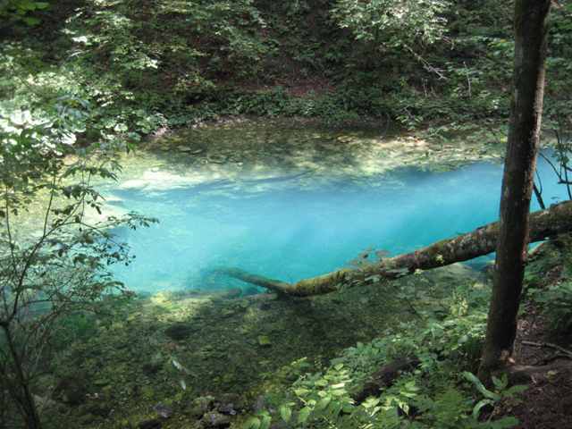
Length canyon Kamačnik from source to mouth is 3 km away. In addition to the stream hiking trails, which goes along the edge of the hour, and partly through a wooden bridge built over the river, to the beautiful green valley, the sources Kamačnik - beautiful karst springs. The spring is located at 410 m above sea level.
It is particularly ecologically valuable part of the area at the foot of the village where Japići sideways torrential streams flowing into Kamačnik and the slopes are covered with thickets of willow and alder groves.
Excursion Kamačnik near Vrbovskog is another tourist destination of Croatian forests. This tourist destination in Gorski Kotar, which consists of a catering facility, ponds and walkways, a distance of 3.5 km in a protected landscape Kamačnik creek, a tributary of the river Dobra, leased by the company since the beginning of this year. Croatian forests are committed to carry out renovation of the catering facility Fisherman's house at the entrance to the canyon, edit-air theater in the walls of a former sawmill, and clean up the environment and repair the bridge over the creek.
Image gallery Order photographs
Location
Coordinates: 45.36736200, 15.07205600 How to get there?
By clicking "How to get there" Google maps will open. Insert your starting adress and click "Get directions". A datailed printable plan will appear.


